Unraveling the mystery of snowflakes, from the Alps to Antarctica

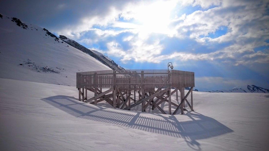
A wooden structure near Davos sheltered the researchers’ camera from the wind. © LTE/EPFL
Using a special multi-angle camera, EPFL researchers have gained important insights into the structure of snowflakes. Their aim is to improve the accuracy of snowfall measurements and winter weather forecasts.
Imagine taking pictures of thousands of snowflakes from three different angles with a specialized instrument installed at an altitude of 2,500 meters. Then imagine using 3,500 of these pictures to manually train an algorithm to recognize six different classes of snowflakes. And, finally, imagine using this algorithm to classify the snowflakes in the millions of remaining pictures into those six classes at breakneck speed. That’s exactly what researchers at EPFL’s Environmental Remote Sensing Laboratory (LTE) did, in a project spearheaded by Alexis Berne. Their pioneering approach was featured in the latest issue of Atmospheric Measurement Techniques.
“The scientific community has been trying to improve precipitation measurement and forecast for over 50 years. We now have a pretty good understanding of the mechanisms involved in rain,” says Berne. “But snow is a lot more complicated. Many factors – like the shape, geometry and electromagnetic properties of individual snowflakes – affect how snow crystals reflect signals back to weather radars, making our task much harder. And we still don’t have a good grasp of the equivalent liquid water content of snowflakes. Our goal with this study was to better understand exactly what’s falling when it snows, so that we can eventually improve snowfall forecast at high altitudes.” Berne also sees other applications for the team’s findings, like a more accurate estimation of water equivalent stored in the snowpack for irrigation and hydropower.

Identifying snowflakes and their degree of riming
To reach their goal, the researchers acquired a Multi-Angle Snowflake Camera (MASC, image 1) – a sophisticated instrument composed by three synchronized cameras that simultaneously take high resolution (up to 35-micron) pictures of snowflakes as they pass through a metallic ring.
In collaboration with the Federal Office of Meteorology and Climatology MeteoSwiss and the Institute for Snow and Avalanche Research, they installed the MASC at a site near Davos, at an altitude of 2,500 meters, where it took pictures for an entire winter and at a site in coastal Antarctica, where it took pictures for an entire austral summer. They then ran their algorithm to classify the snowflake images into six main classes based on existing classification: planar crystals, columnar crystals, graupels, aggregates, combination of column and planar crystals, and small particles (image 2).
Image 1. The researchers’ Multi-Angle Snowflake Camera © LTE/EPFL

Image 2. The six families of snowflakes used by the researchers © LTE/EPFL
The researchers used the pictures taken by the MASC to also determine the degree of riming of each snowflake based on its surface roughness (image 3). “Snowflakes change shape as they fall down the atmosphere – especially through clouds,” says Berne. “Some of them gather frost and become more or less rimed snow crystals [#3-5 in the image], while others remain pristin and have a very low riming index [#1-2 in the image].” Riming is important because it is the process that turns cloud water droplets into precipitation in the form of ice – in other words, snow.

Image 3. Snowflakes with increasing degrees of riming from left to right © LTE/EPFL
Comparing Alpine and Antarctic snowflakes
The next step was to compare the results obtained from the pictures taken near Davos in the Swiss Alps with those taken in Adélie Land on the coast of Antarctica. That revealed significant differences in how often every snowflake family appeared. Most of the snowflakes in the Alps are aggregates (49%), followed by small particles and graupels. However, in Antarctica, the majority were small particles (54%), followed by aggregates and graupels.
According to Berne, these differences can be explained. “The fierce Antarctic winds continually erode the snowpack and result in the formation of tiny snow particles. What’s more, Antarctic snowflakes have much less riming than Alpine snowflakes because the Antarctic air is a lot drier.” Another of the researchers’ findings that will perhaps disappoint purists is that the ‘stellar dendrite’ type of snowflake – the one we typically associate with the ‘ideal’ snowflake – turned out to be rare at both sites, making up only 10% of snowflakes in the Alps and 5% of snowflakes in Antarctica.
Multi-instrumental approach To tackle the complexity of the multiple processes involved, scientists usually rely on several different instruments when making meteorological measurements and weather forecasts. The results obtained by Berne’s team will therefore provide even more insights when combined with other instruments, such as weather radars, which collect data on clouds and precipitation across all layers of the atmosphere.
As part of the international Solid Precipitation Intercomparison Experiment (SPICE), MeteoSwiss set up a rain gauge next to the MASC at the Davos site. The data have not been yet fully analyzed, but by comparing the type of snowflakes photographed by the MASC with the amount of water collected over a given period, the team will be able to test various hypotheses on snowflake liquid water content, which remains an enigma for atmospheric scientists.
A measurement campaign during the 2018 Winter Olympics
To bolster their findings, Berne’s team needs to gather more data. They sent their MASC back to Antarctica for another data-collecting round this year; it will then head to the mountains of South Korea in 2018 for the Winter Olympics which will take place in Pyeongchang. “The more data we have, the more reliable our calculations will be,” says Berne.
This research project combines fundamental and applied research. It involves three scientists: Alexis Berne and Christophe Praz from EPFL’s Environmental Remote Sensing Laboratory and Yves-Alain Roulet from MeteoSwiss (the Swiss Federal Meteorology and Climatology Office). MétéoSuisse has been working with EPFL for several years to improve its precipitation estimates and its numerical weather prediction model.
Reference