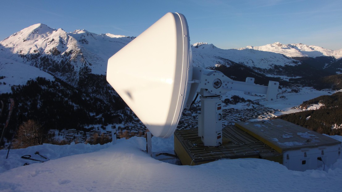
Sensing Snowfall Intensity with a Weather Radar

© 2011 EPFL - LTE
Accurate remote sensing of snowfall intensity is still in its infancy. Having completed a two year field campaign in the Swiss Alps around Davos, Graubünden, researchers from EPFL's Environmental Remote Sensing Laboratory (LTE) hope to have collected enough data to bring it one step closer to maturity.
The intensity of precipitation can vary strongly in response to local meteorological conditions. This is especially true in mountainous terrain, where the rugged topography influences everything from wind patterns to temperature and humidity distributions. Precisely there, remote sensing of snowfall intensity could have a strong impact on the prediction of avalanches and other natural hazards, as well as on water resource management.
Radars are widespread in the measurement of rain intensity. When a short pulse of radio waves emitted by a radar runs into an obstacle in the air such as rain, snow, birds, or planes, part of the signal bounces back and is picked up by the radar's receiver. The returning signal's amplitude, frequency, time lag, and other characteristics allow properties such as size, speed and distance of the obstacle to be inferred.
The way radar waves interact with liquid rain droplets is well understood, and measurements of rain intensity are becoming more reliable. Nowcasting the different forms of solid precipitation using a radar is more difficult, since solid hydrometeors (e.g. snow, hail, graupel) vary strongly in shape, size, and density, depending on the temperature and humidity experienced in their formation. Yet this is precisely what researchers from the EPFL's LTE lab and the Swiss Institute of Snow and Avalanche Research (SLF) have set off to do.
Professor Berne and his colleagues from the LTE lab have grounds for optimism. Their state of the art X-band dual-polarization Doppler (or polarimetric) radar has collected two years worth of radar images from its location on the Jakobshorn near Davos, and scientists from the SLF have provided them with a corresponding set of ground-based snow data. While conventional weather radars emit radio waves with a single polarization, polarimetric radars transmit at two linear orthogonal polarizations (simulataneously in the case of LTE’s radar). Comparing between the signal that bounces back for each polarization provides information on the shape of the obstacles encountered, for instance whether a snowflake is rounded up like a ball or non-spherical. Combining this kind of radar data with measurements collected on the ground, there is hope that a relationship between snowfall intensity, snow type, and the measured radar signal can be found. Back in the lab, the number crunching has begun.