Algorithms to enhance forest inventories

In Switzerland, the national inventory has been updated only every ten years or so. © iStock
An EPFL doctoral student has come up with methods to map out forests more effectively using aerial remote sensing, in support of on-the-ground forest inventories.
Forests are an essential component of the world's ecosystems and a key indicator of our planet's health. They provide valuable resources – like wood for construction and heating – and they filter rainwater, protect against erosion and avalanches, and can be used for numerous leisure pursuits. For these and other reasons, it's important to monitor their development through regular forest inventories. On-the-ground inventories, in addition to being subject to the observers' subjectivity, are costly and laborious and can only be done in easy-to-reach regions. As a result, they are not carried out very often, and only in limited areas. In Switzerland, for example, the national inventory has been updated only every ten years or so since 1985.
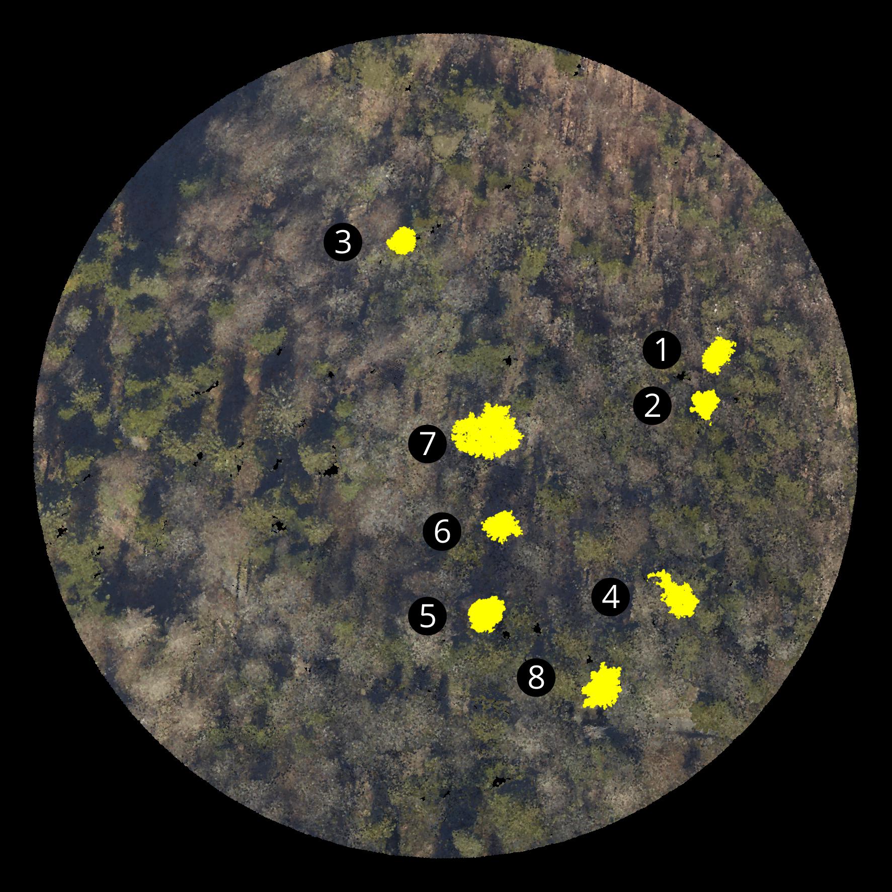
Aerial remote sensing can be a good complement to on-the-ground monitoring. It is more objective and less expensive, and it can cover a larger area. Two techniques are currently used: airborne laser scanning, which determines the three-dimensional structure of the forest, and hyperspectral imaging, which identifies the precise color of the tree canopy, even beyond the visible light spectrum. Scientists know how to collect these two types of data, but extracting the information needed to monitor and manage forests is more complicated.
“Chopping down” 5,000 trees by hand
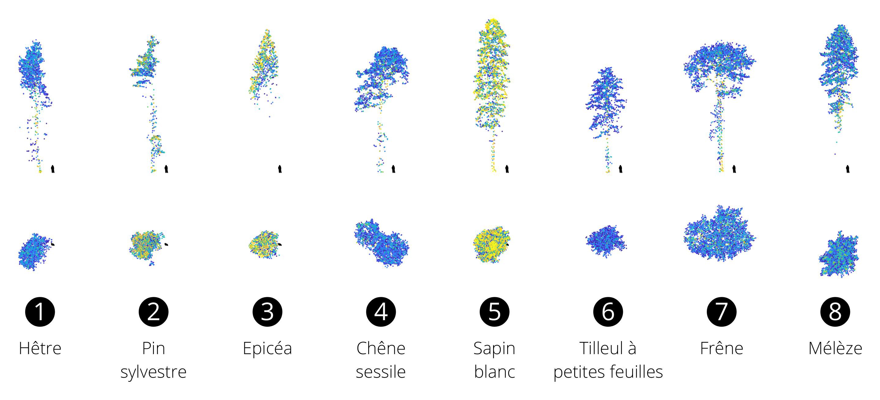
For his PhD thesis, Matthew Parkan, from EPFL's Laboratory of Geographic Information Systems, developed a number of algorithms capable of automatically determining certain inventory parameters – such as trunk location, estimated diameter and species – over large areas. These algorithms can be used, for example, to create a detailed map of an area in preparation for tree marking (prior to cutting), to closely monitor the development of individual trees and to identify habitats more suited to certain animal species.
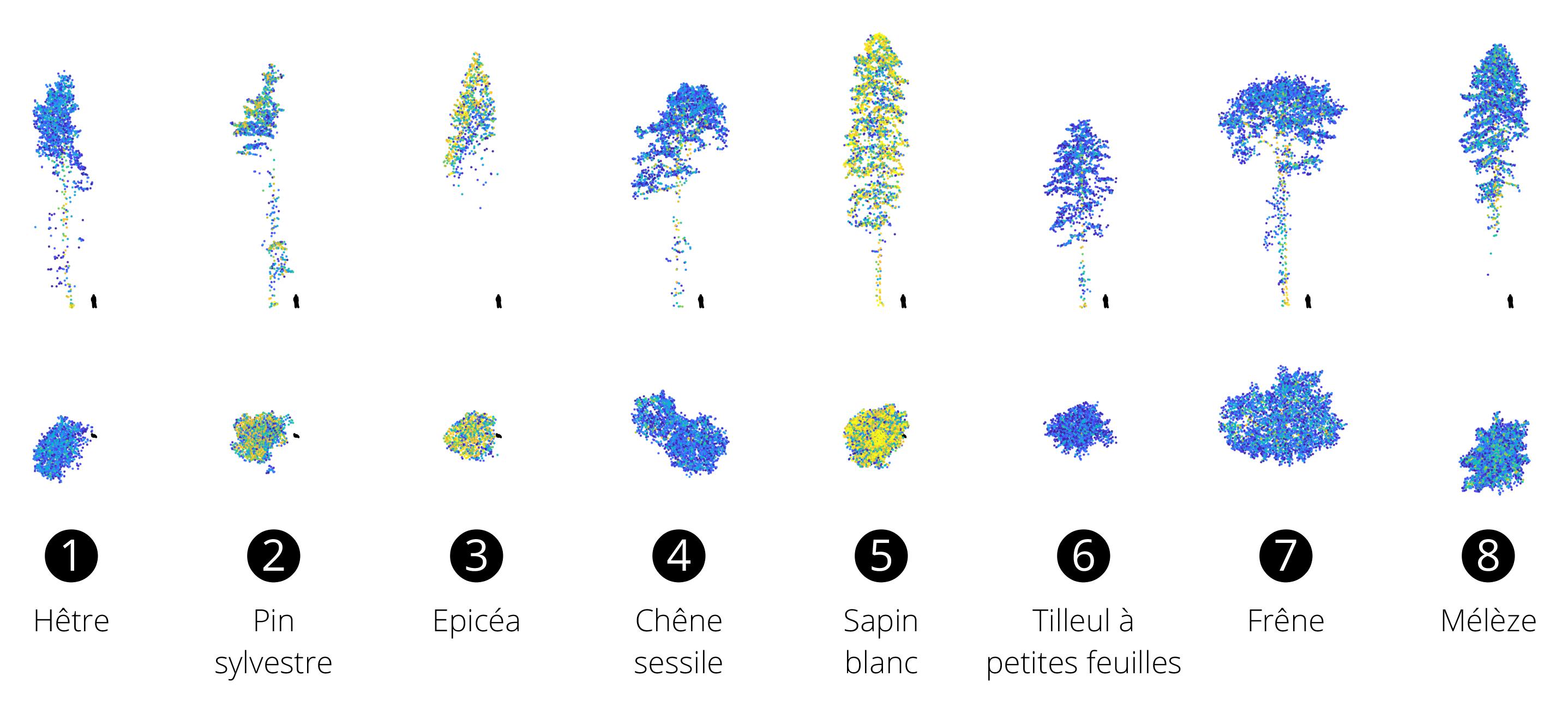
To calibrate and validate his algorithms, Parkan had to build a reference dataset by manually extracting more than 5,000 trees from a 3D point cloud. For this, he created a digital forestry toolbox to facilitate the manual extraction of trees and the visual identification of tree species. This allowed him to verify that the algorithms could reliably detect the location and shape of trees, and to calibrate his classification models for nine tree species commonly found in Swiss forests.
A complement, not a substitute
"My aim was to develop methods and tools that can supplement on-the-ground inventories rather than replace them," says Parkan. On-the-ground inventories are still essential for calibrating models, validating results and identifying subtle characteristics – like the dead wood on the ground, habitat trees and the detailed health of trees – that cannot be detected by most of the aerial remote sensing techniques currently available. Since trees are complex organisms whose shape and spatial structure vary enormously within a forest, it is very difficult to automatically detect all of their characteristics. "For the time being, no algorithm can provide a totally reliable set of results," says Parkan. "That said, huge progress will be made in the coming years as more and more very-high-resolution data becomes available and we develop algorithms that work almost as well as the human brain."
La thèse a été financée en partie par le Fonds pour les recherches forestières et l’utilisation du bois (projet 2013.18) et les cantons de Neuchâtel, Vaud, Fribourg et du Jura.
Combined use of airborne laser scanning and hyperspectral imaging for forest inventories, Parkan, Matthew Josef; Golay, François; Tuia, Devis.